A geometric description of a Heightmap using a quad tree. More...
#include <HeightMap.h>
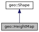
Inheritance diagram for geo::HeightMap:

Public Member Functions | |
| HeightMap * | clone () const |
| HeightMap () | |
| HeightMap (const HeightMap &orig) | |
| bool | intersect (const Ray &, float t0, float t1, double &distance) const |
| intersect: currently always throws a logic error More... | |
| virtual | ~HeightMap () |
 Public Member Functions inherited from geo::Shape Public Member Functions inherited from geo::Shape | |
| virtual bool | contains (const Vector3 &p) const |
| Determines whether a point p lies within the shape. More... | |
| virtual bool | empty () const |
| empty Test whether the shape(mesh) is empty. More... | |
| virtual Box | getBoundingBox () const |
| Returns the smallest box which includes all mesh points. Box is not rotated, but matches the axis of the Shape. More... | |
| virtual double | getMaxRadius () const |
| Calculate the maximum distance from the origin of the shape to any point of the shape. More... | |
| virtual const Mesh & | getMesh () const |
| return the mesh defining the shape More... | |
| virtual bool | intersect (const Vector3 &p, const double radius) const |
| Determines whether the shape intersects a sphere with center p. More... | |
| virtual void | setMesh (const Mesh &mesh) |
| set the Mesh Any child classes should throw a std::logic_error in case the mesh should not be changed via setMesh. More... | |
| Shape () | |
| virtual bool | write (std::ostream &output) const |
| write, serialise the shape More... | |
| virtual | ~Shape () |
Static Public Member Functions | |
| static HeightMap | fromGrid (const std::vector< std::vector< double > > &grid, double resolution) |
| fromGrid: instantiate a Heightmap from a grid More... | |
 Static Public Member Functions inherited from geo::Shape Static Public Member Functions inherited from geo::Shape | |
| static ShapePtr | read (std::istream &input) |
| read serialised data from an input stream and create a shape More... | |
Static Protected Member Functions | |
| static HeightMapNode * | createQuadTree (const std::vector< std::vector< double > > &map, unsigned int mx_min, unsigned int my_min, unsigned int mx_max, unsigned int my_max, double resolution) |
| createQuadTree: divide a grid over a quad tree More... | |
Protected Attributes | |
| HeightMapNode * | root_ |
 Protected Attributes inherited from geo::Shape Protected Attributes inherited from geo::Shape | |
| Mesh | mesh_ |
| Should not be read or written to directly in general. Use setMesh and getMesh to write respectively read the mesh. In a few exceptions, the mesh can be written direcly. Make sure that mesh keeps consistent with other member variables. More... | |
Additional Inherited Members | |
 Static Public Attributes inherited from geo::Shape Static Public Attributes inherited from geo::Shape | |
| static const std::string | TYPE = "mesh" |
Detailed Description
A geometric description of a Heightmap using a quad tree.
Definition at line 15 of file HeightMap.h.
Constructor & Destructor Documentation
◆ HeightMap() [1/2]
| geo::HeightMap::HeightMap | ( | ) |
Definition at line 7 of file HeightMap.cpp.
◆ HeightMap() [2/2]
| geo::HeightMap::HeightMap | ( | const HeightMap & | orig | ) |
Definition at line 10 of file HeightMap.cpp.
◆ ~HeightMap()
|
virtual |
Definition at line 19 of file HeightMap.cpp.
Member Function Documentation
◆ clone()
|
virtual |
Reimplemented from geo::Shape.
Definition at line 23 of file HeightMap.cpp.
◆ createQuadTree()
|
staticprotected |
createQuadTree: divide a grid over a quad tree
- Parameters
-
map heightmap in the form of a grid. Must be square. mx_min indices describing a square region in the map from which to create the node my_min index to describe the region in the map mx_max index to describe the region in the map my_max index to describe the region in the map resolution resolution of the map in meters per index.
- Returns
- pointer to the root node of the quadtree.
Definition at line 194 of file HeightMap.cpp.
◆ fromGrid()
|
static |
fromGrid: instantiate a Heightmap from a grid
- Parameters
-
grid Heightmap in the form of a grid resolution resolution of the grid in meters per index
- Returns
- Heightmap
Definition at line 34 of file HeightMap.cpp.
◆ intersect()
|
virtual |
intersect: currently always throws a logic error
- Parameters
-
r t0 t1 distance
- Returns
- true when the ray intersects the shape
Reimplemented from geo::Shape.
Definition at line 27 of file HeightMap.cpp.
Member Data Documentation
◆ root_
|
protected |
Definition at line 41 of file HeightMap.h.
The documentation for this class was generated from the following files:
 1.8.17